Welcome to KnowHow Daily!
Practical guides, money-saving tips, tech solutions, government benefits, and useful information for everyday life.
Welcome to KnowHow Daily!
Practical guides, money-saving tips, tech solutions, government benefits, and useful information for everyday life.

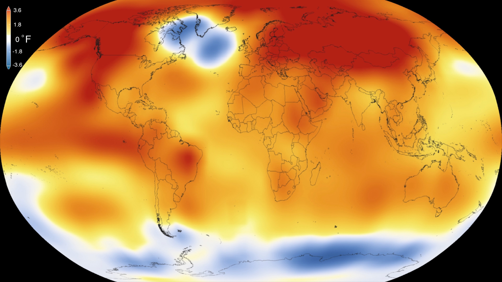
The El Niño 2026 forecast points to a potentially very strong event. Here is what official outlooks suggest for winter weather in Canada and the U.S.
Updated September 7, 2026: El Niño is now firmly established in the tropical Pacific and is expected to strengthen further before reaching a very strong intensity late in 2026. The World Meteorological Organization says there is a nearly 100% chance that El Niño will continue through December 2026–February 2027, while NOAA gives the event a greater than 90% chance of being very strong during the Northern Hemisphere fall and winter.
That does not mean every part of Canada or the United States will have the same kind of winter. El Niño shifts the odds of certain large-scale patterns, but it cannot predict the weather in a particular city weeks or months in advance. Local storm tracks, Arctic air outbreaks, snow cover, ocean temperatures, and shorter-term atmospheric patterns will still matter.
The practical message is that the 2026–27 winter has a stronger-than-usual climate signal behind it, especially from late fall through early spring.
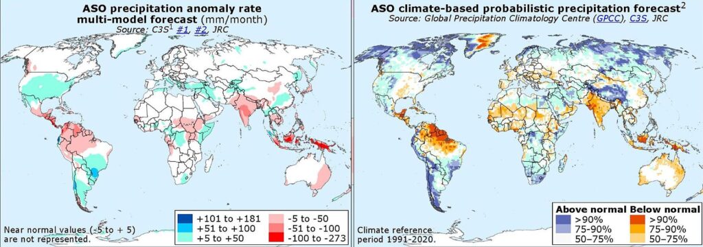
NOAA’s August 13, 2026 ENSO discussion reported July Niño-3.4 temperatures at 1.4°C above average, with even warmer anomalies in the eastern Pacific. NOAA also estimated a 69% chance that the October–December 2026 event could reach a historic strength threshold based on records dating back to 1950.
That is a serious possibility, but it is not the same as confirming a new record. Forecast strength can still change as the ocean and atmosphere interact over the next few months. The most reliable wording right now is that this is likely to become a very strong El Niño, with some chance of ranking among the strongest events observed.
The WMO is also warning that a very strong El Niño can produce major shifts in temperature and rainfall patterns around the world. Those global effects can include heavier rain in some regions, drought in others, and a higher risk of unusual seasonal extremes. The signal is strongest in winter, but it does not control every weather event.
Environment and Climate Change Canada says Canada is affected most strongly by El Niño during winter and spring. Historically, El Niño tends to bring milder conditions to western, northwestern, and central Canada. Eastern Canada usually sees a weaker and less consistent connection.
For the coming winter, that suggests a higher chance of relatively mild stretches across parts of British Columbia, Alberta, Saskatchewan, Manitoba, and portions of Ontario. “Milder” does not mean snow-free or permanently warm. A region can still experience sharp cold snaps, heavy snow, freezing rain, or rapid temperature changes during an overall mild season.
Western Canada may also see changes in precipitation and snowpack. In some El Niño winters, southern British Columbia and parts of the Prairies receive less precipitation than average, although the result depends heavily on the event’s location and strength. Mountain snow conditions can vary from one range to another, so a broad seasonal signal should not be treated as a resort-by-resort forecast.
Central and eastern Canada are more complicated. El Niño’s influence generally weakens farther east, and other climate patterns can override it. Southern Ontario, Quebec, Atlantic Canada, and Newfoundland and Labrador could still see a wide range of winter conditions. A mild seasonal average can include several significant snowstorms.
| Region | Potential El Niño influence | What it does not tell you |
|---|---|---|
| British Columbia and western Canada | Often milder overall, with possible precipitation and snowpack changes | Whether a specific ski area or city will be snowy |
| Prairies | Greater chance of milder winter averages in many areas | Whether Arctic outbreaks will be absent |
| Ontario and central Canada | Some milder conditions are possible, but the signal is less uniform | The number or timing of snowstorms |
| Quebec and Atlantic Canada | Generally weaker El Niño influence | Whether the season will be mild, snowy, or stormy overall |
Environment Canada’s seasonal forecasts are probabilistic, meaning they show the odds of above-, near-, or below-normal conditions rather than promising one outcome. Their reliability also varies by region and by how far ahead the forecast reaches.
NOAA’s seasonal outlook shows a pattern that is broadly consistent with a strong El Niño. During winter 2026–27, above-normal temperatures are favored across much of the western and eastern United States, while parts of the central and southern states have greater chances of near-normal conditions rather than a strong warm or cold signal.
The precipitation outlook is more regionally distinct. Above-normal precipitation is favored across much of the southern tier, with the strongest winter signal in parts of the Southeast. Wetter conditions are also expected across portions of California, the Southwest, and the southern Rockies during parts of the season.
At the same time, below-normal precipitation is favored from portions of the Pacific Northwest into the northern Rockies, northern Plains, and Great Lakes region during parts of winter. That could mean a reduced seasonal precipitation signal in some northern areas, but it does not rule out individual snowstorms or major cold events.
One reason the U.S. temperature forecast is not simply “warm everywhere” is that long-term warming trends are being combined with the typical El Niño pattern. In the South, the competing signals can produce equal chances or near-normal categories even when El Niño would historically have favored cooler conditions.
Not necessarily. El Niño changes seasonal probabilities, not the basic possibility of snow. A city can have a warmer-than-average winter and still receive several large snowfalls if storms arrive at the right time.
In the United States, a wetter southern tier may increase the opportunity for winter storms, but whether precipitation falls as snow depends on the temperature profile near the ground and higher in the atmosphere. In Canada, milder average temperatures can reduce some snow opportunities while increasing the risk of rain, wet snow, or freezing rain in places that frequently hover near the freezing mark.
The safest interpretation is to look at El Niño as a background pattern. It may influence storm tracks and seasonal averages, but it cannot replace short-range forecasts when making travel, heating, or winter-storm decisions.
NOAA’s next ENSO diagnostic update is scheduled for September 10, 2026. Seasonal outlooks will continue to be updated as the event develops, and the most useful information for specific communities will arrive closer to winter.
NOAA ENSO Diagnostic Discussion
For household planning, the best approach is to use the broad seasonal signal now and wait for shorter-range forecasts before making decisions about individual storms. Canadians can monitor Environment and Climate Change Canada’s seasonal forecasts and local alerts, while people in the United States can use NOAA’s Climate Prediction Center and National Weather Service forecasts.
As of September 7, the main status is clear: El Niño is expected to persist through the core of winter and could become one of the strongest events in the modern record. The regional consequences are becoming clearer, but exact local temperatures, snowfall totals, and storm dates have not been determined.
A. Yes. NOAA and the World Meteorological Organization both describe El Niño as established in the tropical Pacific. The remaining uncertainty concerns how strong it will become and how its effects will be distributed regionally.
A. It could rank among the strongest, but that has not been confirmed. NOAA reported a 69% chance that the October–December 2026 event could exceed the strength threshold of previous events dating back to 1950.
A. No. The historical signal is strongest for milder conditions in western, northwestern, and central Canada. Eastern Canada usually experiences weaker and less consistent effects, and short-term cold spells can occur anywhere.
A. Not necessarily. El Niño can shift storm tracks and increase precipitation across parts of the southern United States. Whether that produces snow, rain, severe storms, or flooding depends on local temperatures and shorter-term weather patterns.
A. Seasonal outlooks are useful for broad planning, but they cannot predict individual storms. Local forecasts become much more useful within several days of an event, while official winter outlooks will continue to be updated throughout fall and winter.
Featured image: NASA Scientific Visualization Studio – https://svs.gsfc.nasa.gov / Goddard Space Flight Center – https://www.nasa.gov/centers/goddard / Wikimedia Commons / Public domain